After nearly a half dozen cancellations and last minute changes, I finally made it to the four-pack of mountains near Sheep Meadow. It always seems as though something comes up when plans were set to climb Cherry and Little Cherry hills, and Star and Square mountains, but finally the day came where nothing changed in the forecast or in the lives of those climbing the peaks. It was unclear at this time what the best visual stimulation for the day would be for us but we knew one thing: The hike to Sheep Meadow would be a pleasant one.
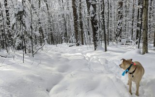
As you may have figured out from my last comment, we started from Mountain Pond Road en route to Sheep Meadow and we did so on a very chilly morning. The sun was promised to us in some fashion throughout the day, but would its rays be enough to warm our vitamin D deficient souls? While no snow was on the ground at the trailhead we suspected that would not be the case as we approached the taller summits of Star Mountain and Square Mountain.

We moved along the trail in a motion much slower than usual, as I think we had trouble walking and talking at the same time. But nonetheless we were at the intersection for Grass Pond relatively fast, and on the foot trail to the meadow. This mile-and-a-half section is a picturesque area even under the dim light and low color palette of late fall. The rolling hills on this segment kind of made me wish for snow so I could ski them, but for today, it could wait. Soon we were back on the forest road and crossing the scenic Hayes Brook bridge. A small, steep climb along the road brought us to a high plateau where elevation change was nearly non-existent, but it was still faintly noticeable. As we neared the lean-tos we came across a path into Sheep Meadow that looked way too good to pass up, so we didn't.

The meadow, which I only assume was once a sheep farm, was a remarkable place where the trees thinned out and unlocked a really interesting backcountry destination. We wandered as if lost through the open fields but eventually realized we needed to get back to the Hayes Brook Road to access our first peak of the day, Cherry Hill.
After our wanderings, we made it back to the trail and continued forward. Just prior to reaching the lean-tos, Corenne noticed another trail leading off to the west and it just so happened to be going in the right direction. Now on this secondary trail, which come to find out is an abandoned section of the Hayes Brook Trail, we made a solid effort in reaching the base of Cherry Hill, which was now only 0.4 miles away.
The Adirondack jungle was open and made for an easy walk through the maples and beeches. The grade was an easy ascent, one that made us feel like we were putting forth no effort at all, and this was the bigger of the Cherry hills. We summited quickly from the trail and found ourselves standing on an open wooded forest summit with not one cherry tree to welcome us. Maybe the black cherry trees had been harvested since the mountain's naming.

From Cherry we could see Star Mountain right in front of us, making for a relaxed navigational effort for us. We didn't even need the GPS to find it. Star stood a few hundred feet higher than us and no sign of snow existed, but at 2,200 feet in elevation, who knows? The descent was an easy one and not even 100 feet was lost, but the climb up Star was sure to be a bit more challenging.
The shallow col came quick and the climb was not that difficult. The closer we got to the summit the more promise it had for a view. There was even a bit of snow under us. We first came to an interesting rock outcropping with decent views -- not stellar but worthy of a few snapshots. We thought that might be it for the views until we continued the remaining few hundred feet to the summit, which opened up with amazing views atop a steep rock slab. From this vantage point we could see Debar and Black Peak, the Sable Mountains, the fire tower on Loon Lake Mountain, Whiteface and Esther, and a large portion of the Great Range. What an amazing seat to have!

Star Mountain has two summits, and as we stood atop the highest one we made plans to traverse over the other to reach Square Mountain. The descent was once again easy through and open forest and the climb followed suit. While no outlooks were had from the top, the descent would prove otherwise. We happened upon a steep cliff area where views of Square Mountain were before us, but the issue was getting off the rocky band. We worked our way down over lip and shelf, sliding on our butts at times and other times making leaps of faith, but we soon got cut off and needed to find other means for a safe descent.

With careful navigation along the steep ledges, we made our way into the deep saddle with Square Mountain. Soon we crossed a flagged trail, and then in the middle of what seemed to be nowhere Corenne spotted an old New York state Department of Environmental Conservation horse trail marker that was half engulfed by the tree it was nailed to. The only thing we figured was that there was a trail at one time back to Star Mountain Pond, but other than the marker we couldn't see hide nor hair of it.
Motoring on after a bit of hot chocolate and a peppermint delight we started the steepest climb of the day on the slopes of Square Mountain. Even with the forest remaining open the leaves made for poor and slippery footing. It was unfortunate that Square was a wooded summit because its potential was quite good and in a prime location for outstanding mountain vistas. We chalked it up as another successful peak as we headed toward the final destination of the day -- the flat ridge of Little Cherry Hill. Sitting at 1,830 feet in elevation, we figured the descent would heavily outweigh any gain we needed to overcome; in fact, we couldn't even make out the flat summit until we were practically right under it.

In the col, we happened across the trail we were on earlier, the unmaintained Hayes Brook trail. The walk up the slopes was nothing more than that, a walk. To the best of our abilities we found the highest point, which resided on top of a boulder in a forest of non-cherry trees.
The descent would prove to be a bit more interesting. While the terrain was easy and mellow, it was almost too mellow. It was hard to keep a straight bearing to where we wanted to go, and passing through the tall stand of white pines we found ourselves in moose country and approaching a moist and very dense wetland.

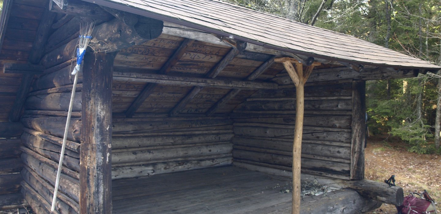
Dan Brook is where we stood, named after Dan. You know, Dan? I can only assume Dan was the name for the beaver that lived there and he sure was an active little fellow. If it wasn't speckled alder we were pushing through it was soggy moss and deep pools of brisk waters that we tried to avoid. Then we stood at Dan's backdoor and walked his plank, which was an incomplete, narrow, partially frozen dam that would once again get us to dry land. It didn't take long, and once we successfully did that we were again on that forgotten trail to Hayes Brook. On our way out we decided to visit the lean-tos and the horse stables at Sheep Meadow, just to get a good picture of them in the fading light. Our retreat back to the trailhead from here was one of haste and deep conversation of where we would explore next. We decided it might be a bit nearer to nearby Meacham Lake, but we shall see.


Comments
Add new comment