Off to Mutton Ridge and the Hardwood Trail
I tried setting the hook with many of my hiking buddies for a Wednesday hike, which could have taken place pretty much anywhere, but with no bites I ended up doing a solo endeavor that landed me in Franklin County. More specifically, I was once again on the Santa Clara Easement, whose span is so large I know I will find myself there again soon. I was looking at going up two separate peaks but landed only one, plus a second hike along a short trail.
With my extended drive through Paul Smiths, I finally found myself on county Route 14, also known as Red Tavern Road. Looking at my map, I saw two distinct trails: One was the Balsam Trail and the other was the Hardwood Trail. I figured I would check them out first. I drove up and back along Red Tavern Road, looking ever so closely for the Balsam Trail. I'm sure it exists in some fashion, but I was unable to find it. It may have fallen into disrepair from lack of use. I mean, it was only about a tenth of a mile long to begin with, so it wouldn't take much for nature to reclaim it, especially in a boreal forest.

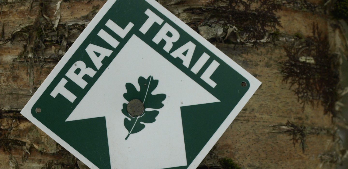
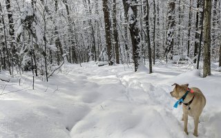
I did easily find the Hardwood Trail. A small signpost with the word "trail" and a trail marker was all that existed, but it was something. The trail, come to find out, is on Nature Conservancy land. The trail was a nice half-mile loop through the woods, a perfect spot for a family walk after visiting nearby Everton Falls. The loop was unbroken and surely unvisited all winter long, and aside from a small bit of ice in the beginning it still had 4 inches of snow on it.

Our summer in March was starting to peak and it was about 60 degrees according to Mr. Subaru. I drove up the road just a bit from here, to the jeep trail that was labeled on my USGS map. The old trail, surely a logging road now, would be the perfect route to my next destination, Mutton Ridge. Don't you just love that name, "Mutton?" It makes me wonder what the origin of such a label is.

Locating the obvious jeep trail, I was in for some "mashed potato" snow wallowing. The snow berm was still over 2-feet high and the county road was narrower for it, requiring me to park mostly in the lane. I strapped on my gaiters, tossed on my rucksack, and off I went. I decided not to use snowshoes, which ended up being an OK move, but I think they would have made it easier in the long run. Punching through downed timber, I sank up to my knees in spots -- yes, my knees -- but mostly it was a bit over ankle deep.
The jeep trail put me closer and closer to the ridge, and as I climbed the snow became less and less. A couple of splits in the trail later, I found myself in a full-on bushwhack to the summit. Well, as full on as walking through pole-sized yellow birch and maples can be. The previous logging activity did open up some seasonal views, and small open areas along the ridge offered me small views off toward Conger, Stacey, Furnace, and Ragged mountains, whetting my appetite for more adventure on the other side of the easement.

The summit was an unfortunate sight and site, for that matter. It was wooded, lightly. I could still see through the open hardwood forest, but it was nothing like I had hoped, with open rock and a warm southern breeze. I must now bid farewell to Mutton Ridge and make my way back down to the car.

The thought of a second peak again crossed my radar, but the road didn't look to be maintained in the winter and I didn't want a lack of traction mishap on such a wonderful day.
New to outdoor endeavors? Hire a guide to introduce you to the world of hiking, fishing, and birding.

Comments
Add new comment