According to the New York state Department of Environmental Conservation's website, the Santa Clara tract easement is 72,000 acres and is comprised of several large contiguous parcels located in the northwestern Adirondacks.
The majority of the tract is located in the towns of Waverly, Santa Clara, and Duane in Franklin County, and the town of Hopkinton in St. Lawrence County. What this means is hikers, bushwhackers, and explorers have a lot more forest land to stomp around on. The tract is open for year-round recreation, which includes hiking, snowshoeing, snowmobiling, camping, fishing, hunting, paddling, mountain biking, and cross-country skiing.
My hiking buddy Brandon and I set out for a winter trifecta in this tract by visiting West, Middle, and Reeves hills. We had no idea what we would find on this little winter jaunt but we were bound to discover something. Brandon, in his typical pre-hike research, checks out Google Earth. Me, I prefer to be surprised; however, the benefit to this is being able to see things that maps might not have. For example, on this trip a logging road from the north would give us great access to the base of West Hill.

We met up at the corner of state Route 30 and 86 in Paul Smiths and carpooled over to the access point Brandon found on Google Earth. No sense in wasting gas, and we honestly didn't know what the parking situation would be. The drive over was a bit hairy as the roads were not all that inviting. It just happened to be one of those winter days this year when we actually got snow. Upon arrival to the area we found the access road very easily. It must have been a highway for logging trucks at one time or another because it was as wide as a regular roadway. The temperatures were bitter cold and the wind cut right through us, like a paring knife to an apple.
The road moved by fast and we crossed the two branches of Goose Pond Brook with no issues. The road has surely been closed to vehicles for some time, as all of the culverts have been removed and deep troughs and berms were all that remained. The logging road split on a couple of occasions, and surely we would be using one of those on our return route from Reeves Hill.
The logging road we were on delivered us to within 0.3 miles of the summit of West Hill, which we did not mind in the least. The forest from this point was somewhat open due to heavy harvesting during the past decade. Unfortunately, the brambles were growing up relentlessly. Like walking through a cheese grater, we pushed from side to side over the sharp thorns of blackberry bushes. We tried our best to avoid the patches but each and every skid road was now overgrown with them, and we had to cross them to continue gaining the top.

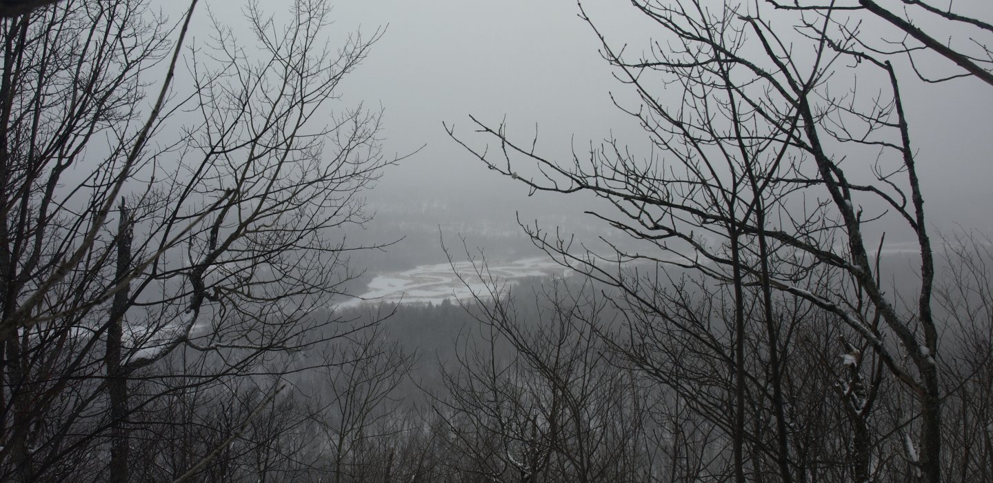
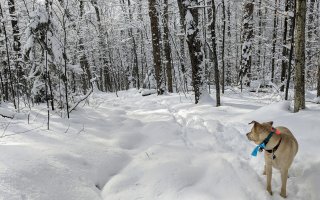
Eventually we were there, and we thought if any of the three would have a payoff, this was it. The top was wooded, but on the south side the steep slopes opened up some partial views into a marshland and over toward Middle Hill. Unfortunately for us the weather was not helping the viewing cause any. We then took our bearing to Middle Hill.
.JPG)
The descent was a steep one, and with periodic cliffs and jumbled rocks it wasn't all that slow going. We were happy to see the logging was not part of this aspect. That wouldn't last long, though. Once we entered the valley the harvesting efforts returned, and more skid roads produced a black bear haven of berry bushes. But now mixed in were a dense growth of fire cherry trees, another species that loves open sun and freshly opened spaces. West came to us quickly, even in the event of thicker vegetation, and to our surprise it had OK filtered views, due to the cutting, I'm sure.
.JPG)
We didn't hang around too long before we decided it would be in the best interest of returning to a warm car if we kept moving along. Reeves Hill was the next and final destination. It was close -- real close -- so as you can imagine it didn't take us long to tag the top. We didn't have much in the way of brambles to battle, and on the way we crossed what we figured would be the perfect road to follow back out. The final ascent to the top was very steep with hardpan snow and the traction was perfect. The long summit area was wooded, but with a bit of poking around we found some closer views of the wetland we saw off West Hill.

It was now time to descend back to that logging road we just discovered and follow it, hopefully back to the one we used at the first part of this frozen day. It worked out quite well, as the old road bent left when it needed to, right as appropriate, and eventually dropped us off, not where we thought it would, but along that other road nonetheless.
It was now time to start dreaming about a warm car and a warm beverage, neither of which would come quick enough and both would need to be prepared. Our faces were burning from the wind and cold, and our fingers were blue from the numbing temperatures we were in all day, but overall it was an interesting experience in the Santa Clara Tract, where we would surely return before the winter was out.
There are a lot hikes and attractions to keep you busy in the Malone Region. Whether you're looking for quirky or history, you'll find it here!

Comments
Add new comment